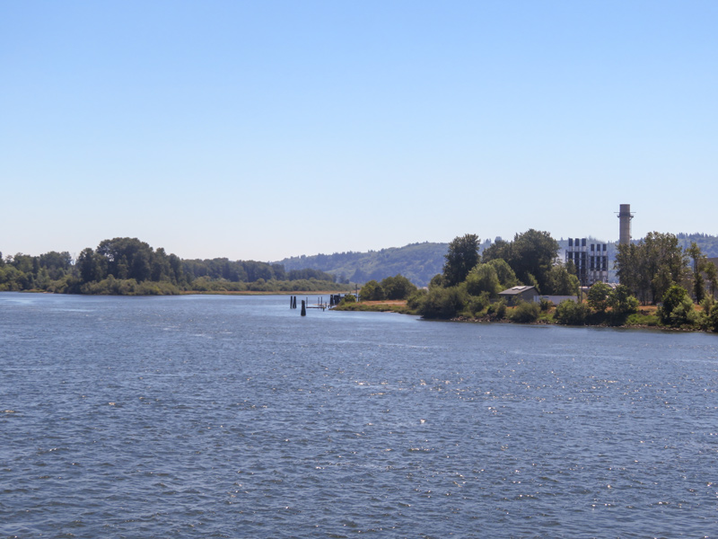
Bradbury Slough
© 2021 by Robert Heacock. Used by permission.
Today, a power plant replaces Winship’s trading post at the upriver end of what Clark called “Fanny’s Bottom” and part of the homelands of the Skilloots.
The Skilloots were an Upper Chinookan group that spoke the Clackamas dialect of the Chinookan language. They were located on both sides of the Columbia River above and below the mouth of the Cowlitz. At first, the captains applied the name over a much wider area, perhaps misinterpreting a similar Chinookan expression meaning ‘look at him!’. Cape Horn, a few miles east of Washougal, was named sqúlips, and could be the origin of the tribe’s name.[1]Michael Silverstein, Handbook of North American Indians: Northwest Coast Vol. 7, ed. Wayne Suttles (Washington, D.C.: Smithsonian Institution, 1990), 545. Note that the upper Cape Horn is named here, … Continue reading In 1806, captains estimated the people’s population to be 2500 souls.[2]Moulton, Journals, 6:484.
The Winship Expedition
On 26 May 1810, the storied ship Albatross captained by Nathan Winship and first-mate William Smith crossed the Columbia River bar intent on being the first to establish a trading post in what would become the Oregon territory. Up the river, past Lewis and Clark’s Dismal Nitch, the party anchored their big ship, and continued up the river to a summer village site of the Skilloot called qániak, Conniac or Konnaack. They had with them twenty-five Kanakas, Hawaiian laborers, a practice successfully employed by the Hudson’s Bay Company at Cowlitz Farm and Fort Vancouver. An extensive bottom on the south side of the Columbia displayed the first oak trees they had seen since entering the river, so they named the cliff at the upper end Oak Point. On 26 March 1806, Captain Lewis and Captain Clark had named the flat Fanny’s Bottom.[3]Oak Point was the commonly used name at least through the Wilkes Expedition of 1841. It is presently known as Port Westward and not to be confused with several other Oak Points on the lower Columbia. … Continue reading
When the Winship party’s main building had been raised to a height of ten feet and their crops planted, the Columbia River flooded the site forcing them to float their logs down the river and build on higher ground. The watchful Chinook were not pleased with the trader’s choice of location and told them that the Chinook people’s traditional role as intermediaries was being ignored. Both sides were called to arms and Captain Winship came to understand that the post could not be defended once the Albatross left the river. After just three weeks in existence, the trading post was abandoned. When the ship returned the next year, William Smith was now at the helm, and he discovered that the presence of Astor Company’s Fort Astoria signaled the end the Winship Brothers’ plans on the Columbia.[4]Hubert Howe Bancroft, History of the Northwest Coast, vol. 2 1800–1846 in The Works of Hubert Howe Bancroft, vol. 28 (San Francisco: A. L. Bancroft, 1884), 129–135. See especially the excerpt … Continue reading
Final Years at Oak Point
The Konnaack Skilloot would never become significant traders and in 1851, Skilloots on both sides of the river ceded their lands in a treaty negotiated by Superintendent of Indian Affairs for Oregon Territory, Anson Dart. In return, they were given gifts and allowed to live and hunt on their traditional lands at Oak Point.[5]Robert H. Ruby, John A. Brown, and Cary C. Collins, A Guide to the Indian Tribes of the Pacific Northwest (Norman: University of Oklahoma Press, 2010), 295.
Selected Pages and Encounters
November 6, 1805
Little Cape Horn bivouac
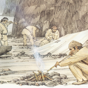
The men paddle down the Columbia in the rain interacting with several villages near the mouth of the Cowlitz. In the evening, they build large fires to dry out and kill the fleas infesting their blankets.
Our Partners


Send feedback or a correction
Spotted something wrong, missing, or want to contribute? Tell us — we read every submission.