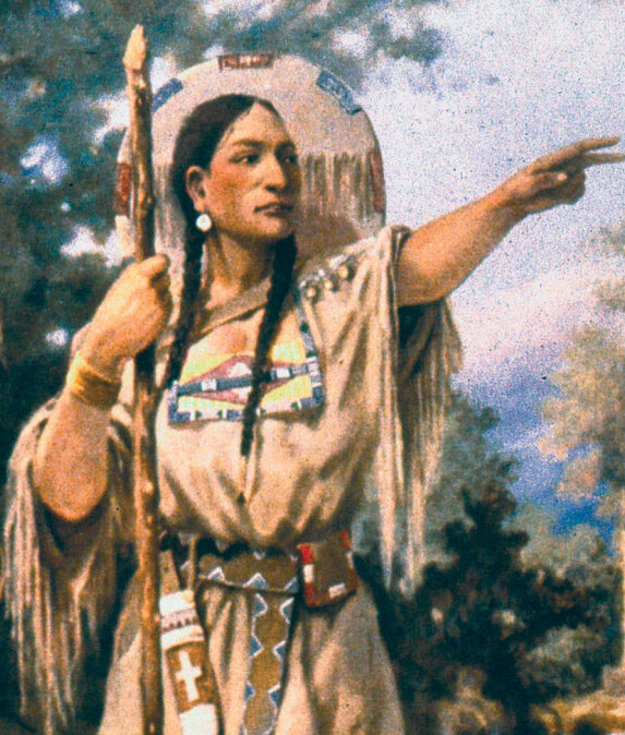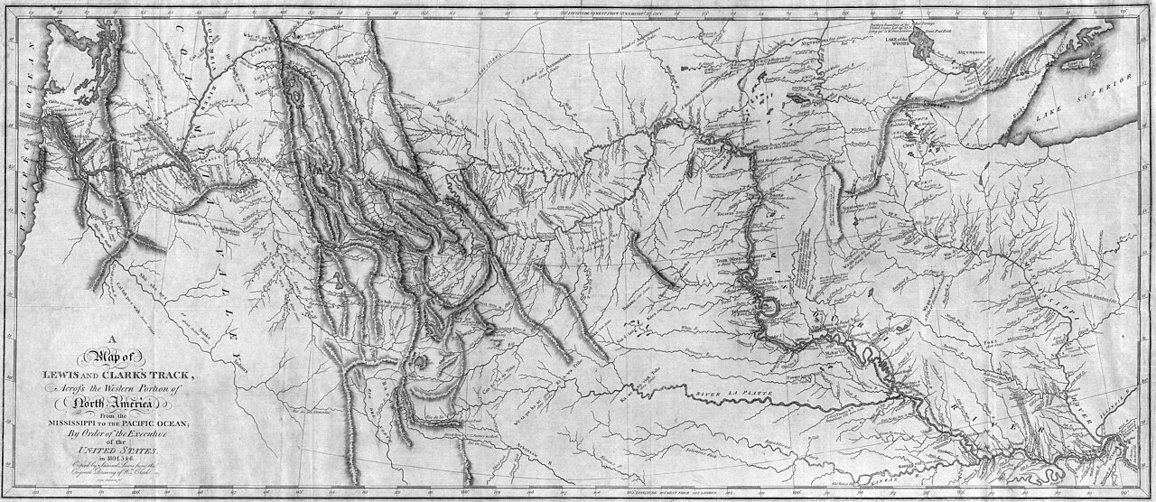
Map of Lewis and Clark’s Track (1814)
The 1814 “Map of Lewis and Clark’s Track, Across the Western Portion of North America” is an engraved map that synthesizes the geographic information gathered during the Corps of Discovery’s 1804–1806 expedition. It depicts the trans-Mississippi West from the Missouri River drainage across the Continental Divide to the Pacific coast, showing river systems, mountain ranges, tribal locations, and the route followed by the expedition. The map covers roughly the area from the Mississippi to the Pacific and from the Spanish settlements of the Southwest to the Canadian fur country. River courses—particularly the Missouri, Yellowstone, Snake, and Columbia—are rendered in considerable detail, while the Rocky Mountains appear as a complex system rather than the single ridge earlier mapmakers had imagined. The engraving is rendered in black line on a single sheet, with hatching for relief and italicized labels for tribal nations and tributary streams.
The map was drawn by William Clark, who served as the expedition’s principal cartographer, and engraved by Samuel Lewis (no relation to Meriwether Lewis) of Philadelphia. It was published in 1814 as part of the Nicholas Biddle edition of the expedition journals, “History of the Expedition Under the Command of Captains Lewis and Clark,” issued by Bradford and Inskeep eight years after the Corps returned to St. Louis in September 1806. The long delay reflected Meriwether Lewis’s death in 1809 before he could prepare the journals for publication and the subsequent transfer of the editorial task to Biddle and Paul Allen. Clark continued to refine the manuscript map during these years, incorporating information from fur traders, including Manuel Lisa’s men and George Drouillard, that postdated the expedition itself.
The 1814 map represented the most accurate cartographic depiction of the American West then available and remained the standard reference for the region for several decades, shaping the work of later mapmakers including Aaron Arrowsmith and Albert Gallatin. It corrected longstanding errors about the width of the Rockies and the supposed proximity of the Missouri and Columbia headwaters. The Library of Congress holds an original impression in its Geography and Map Division, and the map is regularly reproduced in scholarship on the expedition and on the early cartography of the West.