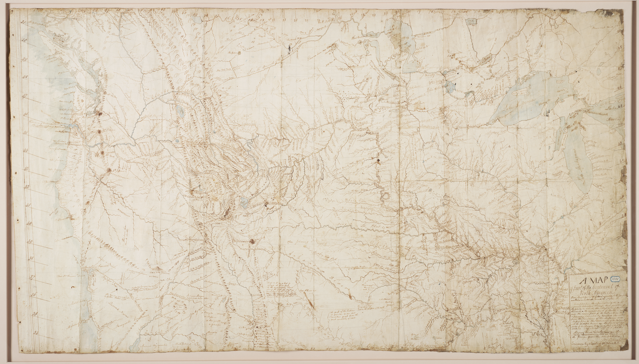
Clark’s Manuscript Map of 1810
Clark’s manuscript map of 1810 is a hand-drawn cartographic document covering the trans-Mississippi West, executed in ink on paper. It traces the courses of the Missouri, Yellowstone, Columbia, Snake, and their major tributaries, along with the principal mountain ranges encountered by the Corps of Discovery. The map records Indian nations across the region with annotations on their locations and approximate populations, and it shows the overland routes followed by the expedition between the Mandan villages and the Pacific. Clark drew on his field sketches, celestial observations, and information gathered from Native informants, fur traders, and later western travelers including George Drouillard and John Colter, whose reports on the Yellowstone country and the Bighorn drainage are visible in the map’s interior detail.
The map was prepared as the working draft for the engraved map that would accompany the Biddle edition of the expedition journals, eventually published in 1814 as History of the Expedition under the Command of Captains Lewis and Clark. Clark continued to revise his cartography for years after the return to St. Louis in September 1806, incorporating new geographic intelligence as it reached him through his position as Superintendent of Indian Affairs for Louisiana Territory. By 1810 he had produced a synthesis that significantly corrected earlier conceptions of western geography, particularly the breadth of the Rocky Mountains and the absence of any short portage between the Missouri and Columbia drainages — a refutation of the Jeffersonian hope for an easy Northwest Passage.
Clark, the expedition’s principal mapmaker, had no formal training in cartography but developed considerable skill through military service and frontier travel. The 1810 manuscript is among the most consequential American maps of the early nineteenth century, serving as the basis for Samuel Lewis’s engraving of 1814 and shaping geographic understanding of the West for a generation. It is held by the Beinecke Rare Book and Manuscript Library at Yale University, where it remains a central document for scholarship on the expedition. The map has been reproduced and analyzed extensively in the cartographic literature, including in John Logan Allen’s and Gary Moulton’s studies of expedition geography.